
Q&A: Keith Conville, North Regional Director of GIS Association of Alabama
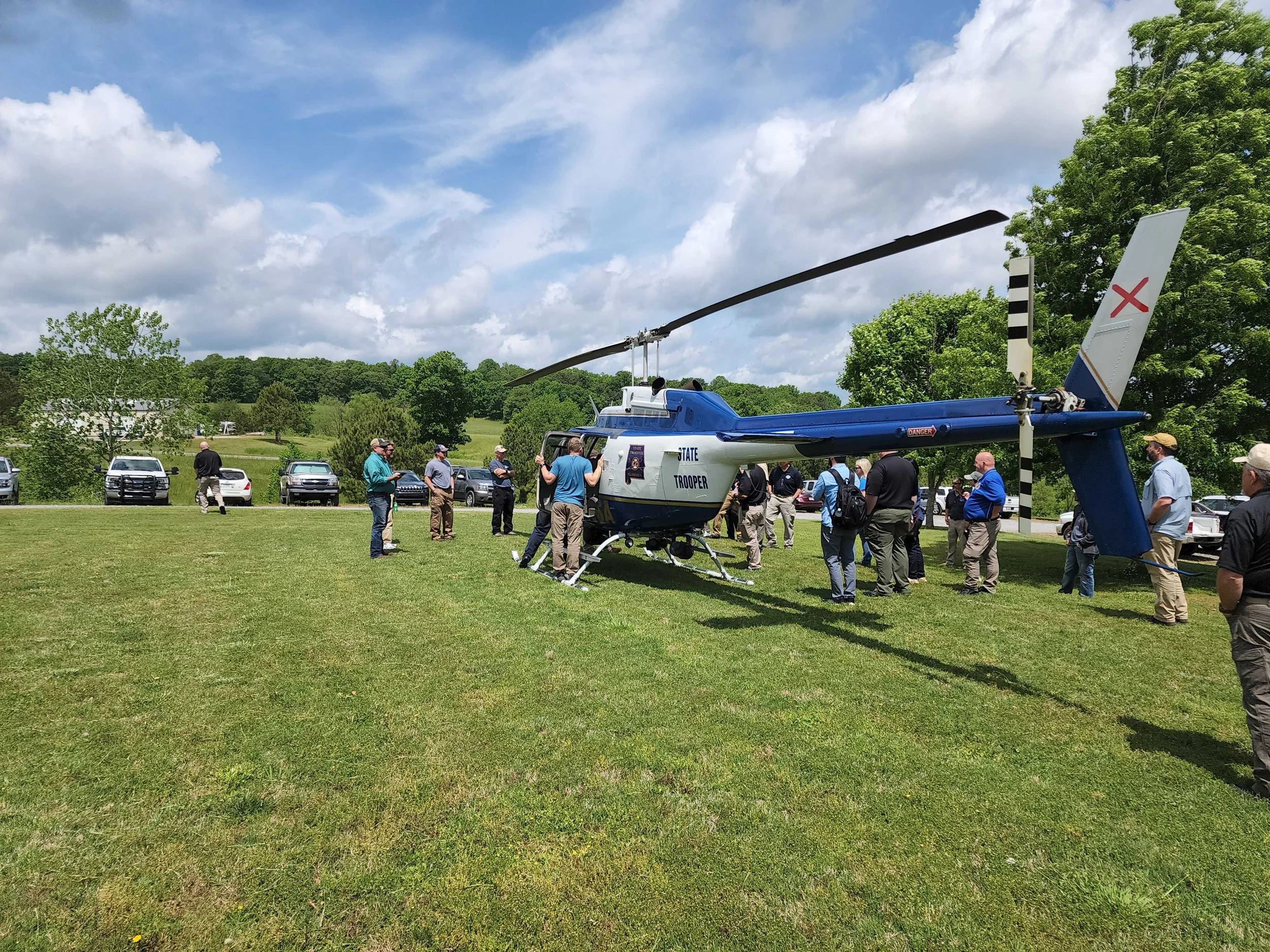
Onsite at GISAA’s recent search and rescue training exercise in Baileyton, AL. Courtesy of Keith Conville
This spring, the GIS Association of Alabama held a two-day search and rescue training event that brought together several organizations and individuals from across the northern region of the state. We spoke with Keith Conville, the North Regional Director of GISAA and GIS coordinator for the City of Madison, Ala., about lessons learned from the event and ways to effectively leverage GIS for search and rescue.
Equipped: What are the emerging GIS techniques and technologies that have been incorporated into your region's search and rescue operations within the past few years?
KC: I'm not a search and rescue person, but I’ve learned some valuable takeaways from what I have been involved in as a GIS user. One of the largest takeaways was the use of live tracking of the search teams. Leveraging maps-based apps with live tracking serves a huge role, allowing us to know where people are at all times and the terrain they may encounter.
I've learned that EMA offices really need to have updated topo maps and aerial photography all overlaid with the United States National Grid (USNG) in a GEOpdf format or something that can be imported into an app like SARTopo or other GIS platform pre-made as the data is available. In the event something happens, the most up-to-date maps are ready to load and go with tracking capabilities on top of it. When sending ground crews into an area, pre-built topo maps allow the planning teams to have quick access to the latest data and know where they can get ground crews in and by what method, whether ATV, walking, or possibly lowered from the air.
Equipped: What are the hurdles to implementing those new techniques and technologies?
KC: One of the largest hurdles is educating those who are in the role of incident command and incident planning to know what resources are available to them and convincing them to leverage those tools. There are people out there who know how to use the tools, but unless the IC knows to call them in at the beginning, it can really delay the effectiveness and success of the mission.
The tools themselves aren't that difficult to use. But, having the correct data to load into them can accelerate the effectiveness, such as the pre-made, ready-to-load maps I spoke of. Another hurdle that we experienced in the field was that of sparse cell service. We used plum cases to convert the cell signal we had to WiFi, but it did limit the speed at which data could be published and used. That can be critical.
Along the lines of educating those in command of the resources available, here in Alabama, the Alabama Law Enforcement Agency (ALEA) is willing and ready to help with air support, as are unmanned aircraft systems (UAS) teams.
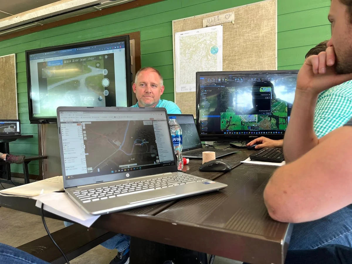
Keith Conville onsite at the recent GISAA training event. Courtesy of Keith Conville
Equipped: What's on the horizon? When you look to the future of GIS and search and rescue, what tools are in development that we might see five or 10 years down the line?
KC: As an organization, a few of us in GISAA are looking into creating ready-to-go templates that can be imported and used out of the box into an Esri platform. Those services could then be published and pulled into other SAR tools like SARTopo so everyone can have easy access through an app or browser.
Setting the Esri Tracker tool up on-site during an event could become cumbersome, especially when trying to drill down to a “per person” level. So, if we could set up a template that is ready to use, someone could take that template and configure it to the specific situation very quickly and be ready to go. The challenge to that is, we can only create a template for what we know. That is search and rescue in either a wilderness environment, or in a natural disaster environment such as a tornado, flood, or hurricane. Another tool to be leveraged is better, effective use of UAS coupled with the manned air support to provide real-time data.
Equipped: Can you give us a general sense of what went into the planning and implementation of the Mock SAR event you recently coordinated?
KC: I’ve been involved with a couple of these, but each time we did things very differently. A lot of that had to do with having different Incident Commanders. Our goal for these events is to create some type of workflow that could possibly be adopted by the State. That would set standard operating procedures that would stand true for almost any incident across the state and be used to train those who will end up in command.
There will always be exceptions, of course. In the first event, we focused a lot on ground search techniques. We were having some issues with our UAS teams and communication between them and manned air. That can be dangerous. So, this time, our focus was a lot on getting manned air support and the UAS teams working better together and keeping air separation while being effective in our goals given by the IC. We had a designated air boss specifically for that purpose, and it worked excellently.
We found that having a two-day event worked well, as the first day is mostly classroom and learning the techniques that will be used; the dos and don’ts, what’s been found to be effective and what hasn’t. A large takeaway from that is knowing to call ALEA at the very beginning. ALEA stated in our event that notifying them as quickly as possible allows them to get on scene in a timelier manner when that initial time is critical. Even if you end up not needing them, they need early notification and don’t mind helping.
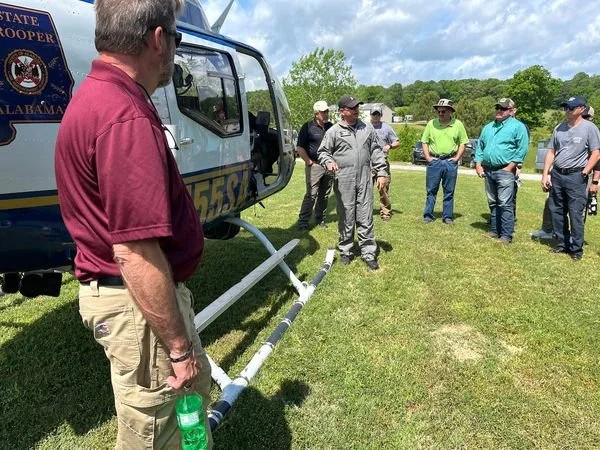
Courtesy of Keith Conville
While waiting for ALEA, or whoever can provide manned air support, UAS teams can be deployed and already in the air doing critical mapping while others look on larger monitors actively looking for anything mission-specific that may stand out. The wrong thing to do is a shotgun ground search where no one is being tracked. When ALEA or UAS are in the air, they don’t know who is who on the ground, whether you are part of the search crew or the person they are looking for.
We found that by allowing the air support, if available and able, to come in and do the initial scan, we can eliminate a lot of ground to cover. Also, ALEA can search with the FLIR unit (thermal imaging infrared camera) on the aircraft to see a person easily. If there are a lot of people already in the area without any type of strobe or anything to distinguish them from the subject, it’s difficult to determine who they are looking at and it depreciates the effectiveness.
Often, they can spot the person in about 15 minutes. If the air support spots a person, or signs of a person in the area, then the ground crews are sent into a very specific area and know what they are looking for, still using bright clothing or strobes to distinguish. Most of the time, the air support can walk the crew into the area if needed. This is also where the GIS comes in. It can be difficult to tell ground terrain from the air, so those pre-made maps are used to see if the crew can get in there, and by what means. These techniques were very effective during this last event. The live tracking also allows us to know where everyone on the search crew is, and that also can be communicated to the air support or even displayed on their device so that they know if they are looking at someone on the search crew or a possible subject.
As for the planning, we reached out to our local EMA office, the Alabama Association of Rescue Squads (AARS), several law enforcement agencies as well as fire agencies, ALEA, and UAS Huntsville. We asked a representative the AARS to be Incident Commander this time. So, from that group, the founder of RAT-SAR was able to come and be our IC. He brought a crew with him that was able to create mock scenarios that emulated events he had been involved in. We used a gentleman that was our IC of our last event and who also provides training for search and rescue, Scott Watkins, to be over the ground search crew. The IC then used those in attendance to form the rest of the team.
On day 2, and after demonstrating how an incident should be implemented, he allowed others to be IC and see how they did. We ran several scenarios that were different each time. I feel everything worked really well. However, I feel that the GIS portion could have been leveraged a little more. That would have been especially effective in our last scenario, when a member of one of the last search crew didn’t return to sign out of the incident (another mock scenario). If we had our template set up that we are working toward, each person on the team would have had a different symbology and name associated.
This was another challenge in the on-site setup of the incidents. We were only able to track teams by color. So, each person on a team was represented with the same symbology, and we weren’t able to distinguish who was who on the team. We had two teams, and all we were able to see was several lines of red, and several of blue. If we had the ready-to-use template available, we would just enter the person’s name and team number, and he/she would have been assigned a unique color on the tracking device, enabling us to see the last known location of the person who didn’t return.
Each time we do one of these, I feel we are getting much closer to having something we can propose as SOPs. We are planning another this year for certain, and we may do another in our area in the fall. Since the techniques learned should be able to be implemented no matter the type of incident, unless criminal and the person doesn’t want to be found, we are possibly going to try a mock natural disaster next time to see how the same techniques work in that environment.
RELATED: Watch our recent webinar on GIS for search and rescue.